Table of contents
Cairns Southern Cycleway
If you’re seeking a scenic and adventurous cycling route in Far North Queensland, the Cairns Southern Cycleway is a must-visit destination. This comprehensive guide provides all the information you need to plan your trip, including trail highlights, difficulty level and tips for a safe and enjoyable ride.
Get ready to explore the stunning landscape of this beautiful region on two wheels.

Cairns Southern Access Cycleway
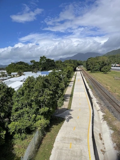
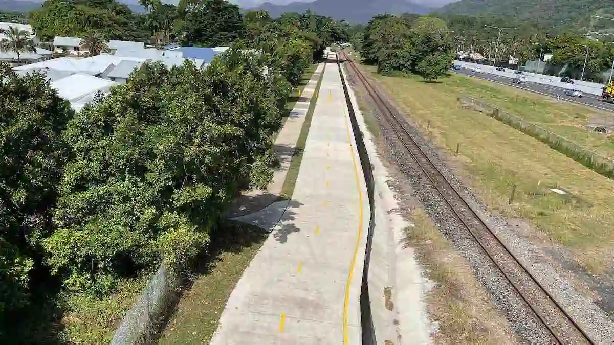
While referred to as the Cairns Southern Access Cycleway in early documentation, that name is rarely used. It was later officially named ‘The Luke Azzopardi Cycleway’ running from Riverstone Road, Gordonvale to Ruth Street, Woree.
Mr Azzopardi was a Gordonvale resident who was well-respected and made significant contributions to sport and the community. This new cycleway provides safer connections to several schools, businesses and shopping precincts south of Cairns.
Cairns Southern Access Corridor (Stage 5)
The Cairns Southern Cycleway is a 17-kilometre trail that winds through the lush rainforests and coastal landscapes of Far North Queensland. The trail starts at the Cairns Esplanade and takes you through the suburbs of Woree, and Bentley Park before ending at Gordonvale.
Along the way, you’ll encounter stunning views of the surrounding cane fields and mountains. The trail is suitable for cyclists of all levels, with plenty of rest stops and amenities along the way.
This new off-road bike path completes the missing links from Cairns all the way south to Gordonvale. It makes it safe for riders of all ages and abilities to travel from Cairns to neighbouring townships. This cycleway was being built along the Cairns Southern Access Corridor as part of stage 5 of the Cairns Bruce Highway Upgrade Masterplan.
Cairns Southern Cycleway Map

Cairns Southern Cycleway Route Map
The department has provided background information on their website, including their Cairns Southern Cycleway Route Map.
Cairns Bike Path Map
The cycleway provides a crucial link connecting the suburbs south of the city. This infrastructure provides a dedicated and safe link for all bike riders including school children between Edmonton, Mount Sheridan, White Rock and Woree.
The cycleway provides safer connections to several schools, businesses and shopping precincts south of Cairns.
Road Cycling Cairns
Cairns is a fantastic location for road cycling, offering a range of scenic routes that suit both casual riders and serious cyclists. The region’s tropical climate, coastal views, and proximity to rainforests and mountains make it a unique spot for cycling enthusiasts.
Cairns Cycling Routes
Be mindful of traffic, especially on routes like the Captain Cook Highway, which can get busy. Always wear a helmet and follow road rules.
Cairns has a tropical climate, so early morning or late afternoon rides are best to avoid the midday heat. During the wet season (November to April), heavy rain can occur, so be prepared for changes in weather conditions.
The Cairns Southern Cycleway offers a great off-road option in South Cairns. In addition, you can find helpful information in the Cairns Cycling and Walking Guide. Cairns’ combination of breathtaking scenery and challenging terrain makes it a prime destination for road cycling in Australia. The following routes are highly popular.
Captain Cook Highway (Cairns to Port Douglas)
One of the most scenic road cycling routes in Far North Queensland, stretching along the coastline. The ride from Cairns to Port Douglas offers stunning ocean views, with the road winding between the Coral Sea and the tropical rainforest.
Distance: Approximately 67 km one way.
Terrain: A mix of flat and hilly sections.
Best for: Experienced cyclists due to the traffic and elevation.
Kuranda Range
A challenging but rewarding route that takes cyclists from Cairns up the Kuranda Range to the rainforest village of Kuranda.
Distance: About 30 km one way.
Terrain: A steep climb with switchbacks, gaining significant elevation.
Best for: Advanced riders who enjoy hill climbs.
Gillies Range (Cairns to Atherton Tablelands)
Another demanding route that leads to the Atherton Tablelands, known for its scenic views, dairy farms, and rolling hills.
Distance: About 90 km to Atherton.
Terrain: A tough ascent with around 263 corners, perfect for those looking for a serious challenge.
Best for: Enthusiasts who love long-distance climbs.
Lake Morris Road
A shorter, steeper climb that leads to the picturesque Copperlode Dam.
Distance: 12 km one way from the base to the dam.
Terrain: Very steep but offers rewarding views of the dam and the surrounding rainforest.
Best for: Cyclists who want a quick, intense workout.
Bike Path Cairns to Palm Cove
The bike path from Cairns to Palm Cove is part of an expanding trail network known as the Cairns Northern Beaches Leisure Trail. This multi-stage project connects the Cairns CBD to northern beaches, creating a safe, scenic route for pedestrians and cyclists.
Key segments already completed include routes through Holloways Beach and Machans Beach, featuring off-road paths that maximise safety and minimise environmental impact. A notable future addition will be a bridge across Barr Creek, enhancing connectivity while preserving the natural landscape
Cairns Southern Cycleway and the Cairns Cycling Community
Whether it is these routes or the more casual and relaxed off road rides in Cairns, you can enjoy cycling with others.
Cairns has an active cycling community, with groups organizing regular rides and events. Clubs such as Cairns Cycling Club and Triathlon Club often arrange social rides, time trials, and charity events.
Bike Hire Cairns
You can also find local bike shops that offer rentals, repairs, and route advice, such as Trinity Cycle Works, Edge Cycleworks and Discovery Cycles.
Enjoy the Cairns southern cycleway and enjoy your cycling in Cairns.

